
Livermore Neighbor Lookup Record Map
One block can be described by several official layers. Alameda County and City GIS show geometry and address attributes. Assessment and tax records describe each parcel. The recorder links known owners to transactions. Permits show project history and application actors. Historical directories and census schedules can place older households nearby. Voter-file access is limited, and community contacts normally identify an officer or public channel rather than every member.
| Source | What It Shows About a Block | Access |
|---|---|---|
| City and County GIS | Parcel boundaries, APNs, situs, land use, adjacent geometry, city limits | Free map and open service |
| Assessment and tax | Parcel characteristics, values, tax data, and owner route | Free online facts; ownership through the Assessor’s offline channel |
| Recorder | Known owner names, transactions, instruments, legal descriptions | 1969-present electronic index; older office research |
| Permits | Construction, project history, status, applicants, professionals | Livermore Accela or records request |
| Voter file | Address-linked registration information for a qualified request | Restricted statutory purpose; no public block browse |
| Directories and census | Historical occupants and nearby households for a dated period | Library, archives, or collection-specific database |
| Community contacts | Public officer, management, or contact channel | Official community or association page |
The coverage table keeps neighbors research grounded. It does not turn one parcel’s owner record into a statement about everyone on the block.
Map a Livermore Block for Neighbor Lookup
The adjacent-parcel method begins with a complete address or APN. The County Parcel Viewer autocompletes a partial APN or situs address, zooms to the selected polygon, and opens a popup. Pan along the street, click each bordering polygon, and save the APN and situs attributes. Then carry each APN into county assessment or tax search one at a time.
- Normalize the target address and save its APN and situs.
- Open the county or city parcel map and select the target polygon.
- Click each bordering parcel and note APN, situs, land use, and city-limit position.
- Run each APN through assessment or tax records without treating the output as a household list.
- Use the recorder or permit portal only when the question calls for a transaction or project record.
The full named-street chain belongs on the Livermore by-street page. The neighbor lookup stops at the immediate block or radius.
Open Livermore Neighbor Parcel Layers
The City of Livermore ArcGIS parcel layer exposes APN, situs number, street, direction, full street, unit, city, ZIP+4, YearBuilt, EffectiveYear, LotSize, Zoning, LandUseDescription, flood information, flood panel, and ElectionDistrict. The published service supports standardized or advanced queries, statistics, and several output formats, with a 2,000-record and selection maximum. The County GIS layer adds mailing fields, assessed values, exemptions, latest-document reference, and geometry.
Neither service supplies owner names. A map can show that two polygons touch, but it cannot tell whether an adjacent parcel has one household, several households, no current occupant, or a business use. Use the layer for spatial context and pass the APN to the custodian that controls the next record.
| Search | Address or parcel number, with autocomplete or map selection. |
|---|---|
| Identify | Click a polygon to open parcel attributes. |
| Layers | Parcels, address points, city limits, municipality, and available themes. |
| Limit | Open service caps records and selections at 2,000 and omits owner names. |
Use the Livermore GIS map gateway to compare the block with city-limit and municipality layers.
Carry Each Livermore Neighboring APN into Search
For each adjacent parcel, record the situs address, APN, land use, and map position before moving to the property portal. Alameda’s online assessment search accepts address or APN and returns parcel detail, but owner names remain offline. The Treasurer-Tax Collector search accepts address or APN and can return tax-bill information. A shared street, ZIP, or mailing city is not enough to join two parcels.
When ownership is the specific question, use the Assessor public counter, limited telephone inquiry, or written response. Then search a known owner in the recorder index and inspect the document. This route is slower than a name list, but it keeps the result attached to a parcel and a date.
Note: Adjacent geometry shows land relationship; it does not establish a social relationship between the people connected to the parcels.
Livermore Neighbor Ownership Does Not Equal Occupancy
An owner’s mailing address can match the situs, differ from it, or point to a trust, business, post-office box, or other destination. A homeowner exemption can support an owner-occupancy clue, but it does not list household members. A deed party may be a trustee or representative. A permit contact may be an architect, engineer, contractor, owner-builder, or service-request contact.
Describe the record in its own terms. “Owner of record,” “mailing recipient,” “permit contact,” and “historical occupant” are different labels. A neighbor lookup should never convert a parcel list into a roster of current households. The distinction is central to an accurate Livermore residents directory.
- Adjacent parcel
- A mapped parcel sharing a boundary or touching the target geometry.
- Situs
- The physical address assigned to a parcel.
- Mailing address
- The destination used for tax or assessment correspondence.
- Occupant
- A person shown at a place by a dated household, directory, or other source.
Livermore Neighbor Voter Files by Block
My Voter Profile is a self-authenticated service for registration information, polling place, sample ballot, vote-by-mail status, language preference, and eligible districts. It does not offer a public name or street browse. California voter files may be released only for election, scholarly, journalistic, political, or governmental purposes under Elections Code §§2194 and 18109 and 2 CCR §§19001-19012.
An approved identified-voter request needs full name, date of birth, county, residence address, purpose, and certification. The official voter privacy notice describes the fields that stay withheld. Depending on authorization, a file may include name, residence or mailing address, party preference, status, registration date, precinct or district, and participation history. Driver-license or ID numbers, Social Security numbers, and signatures are never released. Safe at Home and other protected records are withheld.
Open the California voter-file request rules before treating a voter result as block evidence.
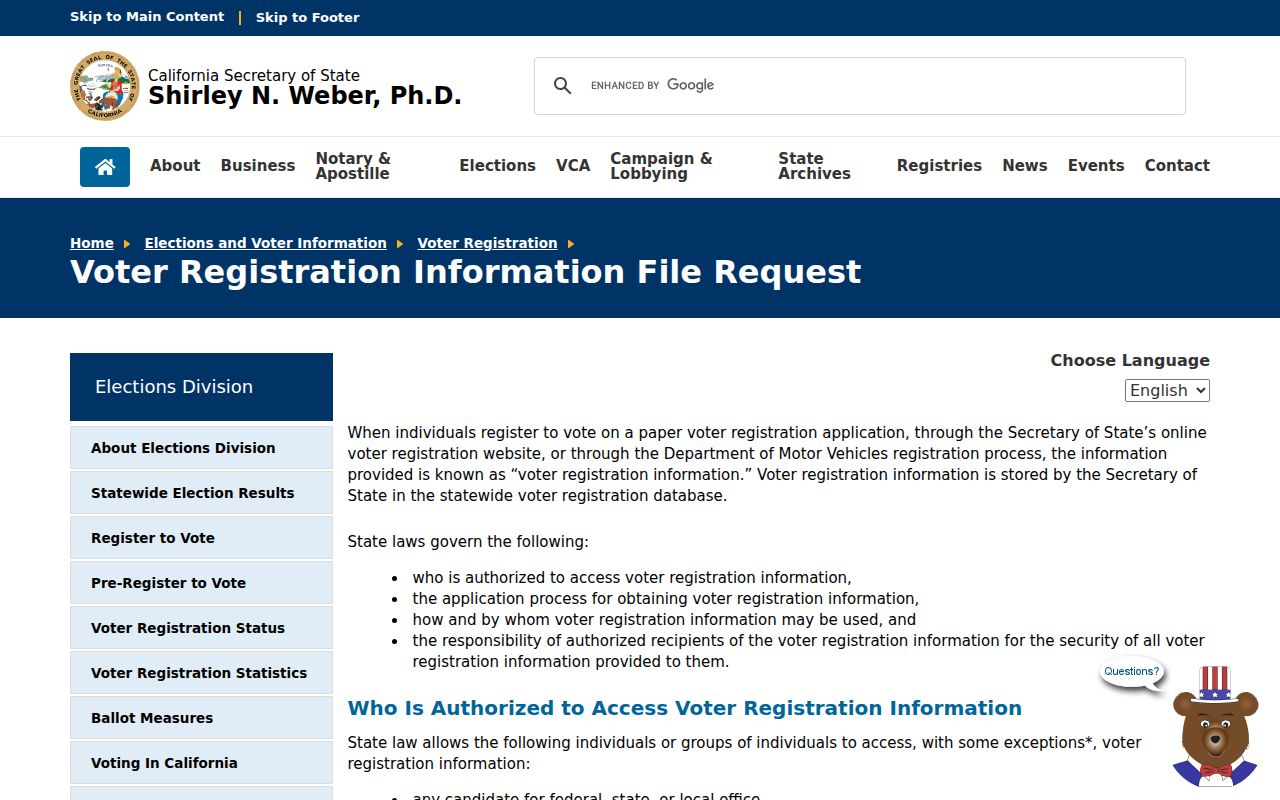
The request screen shows why the public cannot turn My Voter Profile into a directory of Livermore neighbors.
Livermore Neighbor Permits as Block History
Livermore Accela permits can show a project, date, status, record type, parcel, address, and application actors. Search by address, parcel, project, record number, contact, licensed professional, or date range. Building History and City Report can be useful starting categories for older or compiled material, followed by trade-specific permits.
Permit records can explain a new structure, remodel, solar installation, grading action, or street-facing change across the block. They do not prove who lives there. Match the permit parcel to the county APN, and keep the applicant role in the note. A project contact can be a professional working for someone else.
Livermore Neighbor Contacts, Not Rosters
The City’s neighborhood and community resources page is the proper starting point for current neighborhood contacts, but research did not verify an exhaustive City list of every Livermore neighborhood association or directory. Public association pages may identify an officer, management company, meeting channel, or contact form. They do not establish every member or household on a block.
| City neighborhood resource | Current civic contact and community information, subject to the live page. |
|---|---|
| Association contact | Public officer or management channel when the association publishes one. |
| Congregation or civic group | Voluntary public contact or event information, not private membership. |
| Block-watch contact | Public safety or meeting channel when officially published. |
Open the Livermore neighborhood resources page and verify the current contact before relying on it.
Historic Livermore Neighbors in Directories
For an earlier block, use the public census through 1950, local directories when an exact edition is confirmed, the 1877-1899 Livermore Herald run, cemetery and obituary indexes, and Sanborn maps. Census schedules can show a household at an enumeration address. A reverse directory can show an address-to-name entry. A newspaper can place a person near a civic event or property notice.
Compare the same address, date, spouse, occupation, and parcel clue across sources. Nearby names are not automatically relatives or current neighbors. The historical collection’s gaps are part of the evidence, so mark an unverified year or uncertain number instead of filling it from a modern map.
Official Livermore Rolls Versus Neighbor Tools
Official records have a named custodian, a stated access rule, and a correction path. Commercial compilation tools may combine public and purchased material, merge same-name people, charge for fuller results, and lag behind the source. Neither category should be treated as a complete block roster. The official parcel and recorder route is stronger for a property connection, while a library or archive is stronger for a historical household clue.
| Route | Useful For | Limit |
|---|---|---|
| County and City GIS | Adjacency, parcels, limits, and land-use context | No owner or household roster |
| Assessor and recorder | Parcel facts and documented title parties | Owner channel changes offline; parties are not all occupants |
| Library and archives | Historical directories, census, newspapers, and maps | Edition and coverage gaps |
| Commercial compilation category | Possible unverified leads | Cost, stale data, merged identities, and unclear correction route |
Livermore Neighbor Lookup: What Stays Private
A block search cannot publicly identify every household member, occupant, utility customer, delivery recipient, DMV address, or protected voter. Safe at Home uses substitute addresses for eligible participants, and California voter records have purpose and field restrictions. The Assessor’s online omission of owner names is a channel limit, while offline inspection may remain available.
Use only the minimum detail needed for a personal, lawful question. If a record is wrong, contact its custodian for correction. If a result concerns a safety threat, stalking, or harassment, contact the proper law-enforcement or support channel rather than using records to confront someone.
Lawful use. Livermore neighbors research is for personal, family-history, and civic purposes. Do not use a parcel, name, or voter clue to stalk, harass, intimidate, or harm anyone.