
Find a Livermore Street Directory Trail
Begin with one normalized address. Alameda County’s property and tax searches use an autocomplete address or parcel number, and the county parcel viewer can move from that point to the surrounding polygons. An APN is the bridge between map, tax, assessment, and deed records. The street directory question then separates into two parts: which parcel and title record fit the address, and which historical or authorized sources can speak to people connected with it.
Use this order so each source does one job:
- Enter the full street address in Alameda Property Assessment Information and save the APN, situs, use code, and map link.
- Carry the APN or situs into the County Parcel Viewer and click the target polygon.
- Obtain the owner through the Assessor counter, limited phone route, or written response, because the online result omits owner names.
- Search the owner as a grantee in the recorder index, inspect the acquisition deed, and match the legal description or APN.
- Add city permits, civic minutes, directories, census entries, or newspapers when the question concerns an occupant or an earlier era.
Note: A street address identifies a starting point; it does not by itself identify every person connected to the parcel.
Livermore Address Records in One Chain
A strong street directory chain keeps the record sets distinct. The assessment roll describes a parcel. The tax portal supplies bill and APN data. GIS supplies shape, adjacent geometry, and land-use context. A deed names parties to a transaction and gives a legal description. A permit names an applicant or professional who may not be the owner. A voter record is restricted and cannot be browsed as a public street roll.
| Record Set | Keeper | What It Shows | Access |
|---|---|---|---|
| Assessment parcel | Alameda Assessor | APN, situs, values, characteristics, exemptions | Free online facts; owner through offline channels |
| Tax bill | Treasurer-Tax Collector | Tax year, APN, bill and payment data | Free address or APN search |
| Parcel geometry | County and City GIS | Boundaries, adjacent parcels, land use, city limits | Free map and open service |
| Recorded deed | Clerk-Recorder | Grantor, grantee, recording data, legal description | 1969-present index; earlier manual route; paid copies |
| Building permit | Livermore Community Development | Project, dates, status, applicant or contractor | Accela portal or request |
| Historic directory or census | Library, archives, or federal custodian | Period household and nearby addresses | Collection-specific and time-limited |
The table is a workflow, not a claim that every source produces a resident list. For a one-person question, shift to the Livermore resident lookup process and require two independent identity points.
Livermore Street Search Fields
The county property search has a narrow but useful interface. Address and parcel number are alternative routes, and both use autocomplete. Choose the suggested value rather than leaving a partial phrase in the box. The resulting detail may include APN, situs address, parcel map, land and improvement values, tax year, transfer or assessment information where displayed, building characteristics, and a tax-bill link.
| Address | Autocomplete text; select the suggested physical property address. |
|---|---|
| Parcel Number | Autocomplete text; enter dashes and no leading zeroes. |
| Search | Returns assessment and property detail. |
| Owner name | Not published online; request through the Assessor’s public channels. |
That owner-name limit is a central Livermore street directory fact. The Alameda property-assessment instructions explain the address and APN route. A researcher can reach the parcel online, then change channels for ownership. Do not fill the gap with a guess from a tax mailing address or a permit contact.
Open the official property assessment search before comparing an address with the captured property view.
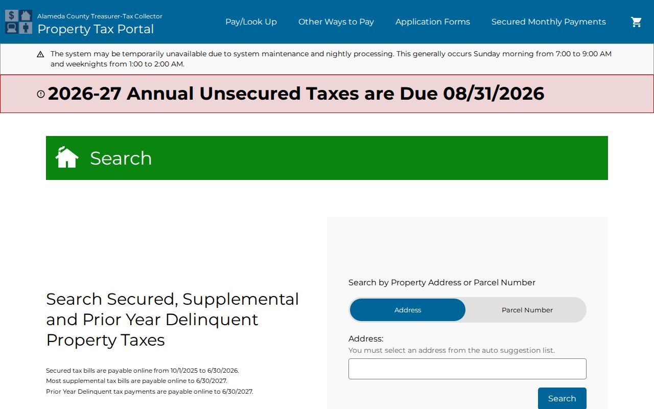
The address route is best treated as a parcel locator. It gives the next identifier needed for tax, GIS, and recorder work.
Browse Livermore Parcels by Street
The County Parcel Viewer searches by address or parcel number, zooms to the matching polygon, and opens a popup. Its controls include pan, zoom, home, overview map, measurement, bookmark, basemap gallery, layer list, print, full screen, and extent navigation. A street browse is done by selecting the target parcel, then clicking or panning across bordering polygons and saving each APN and situs attribute.
The City of Livermore parcel layer adds situs components, YearBuilt, EffectiveYear, LotSize, Zoning, LandUseDescription, flood information, flood panel, and ElectionDistrict. The layer supports advanced queries and a published schema, with a 2,000-record and selection maximum. Neither the county nor city GIS layer is a people directory, and the map does not publish owner names.
| Address search | Geocoder or autocomplete that zooms to a situs. |
|---|---|
| Parcel or APN | Select the mapped polygon and open its attributes. |
| Layers | Parcels, address points, city limits, and available thematic layers. |
| Measure | Square feet, acres, or distance when the tool is exposed. |
Use the Alameda County map directory and the Livermore GIS gateway as the authoritative map starting points. The published Livermore parcel layer supplies the schema and query limits.
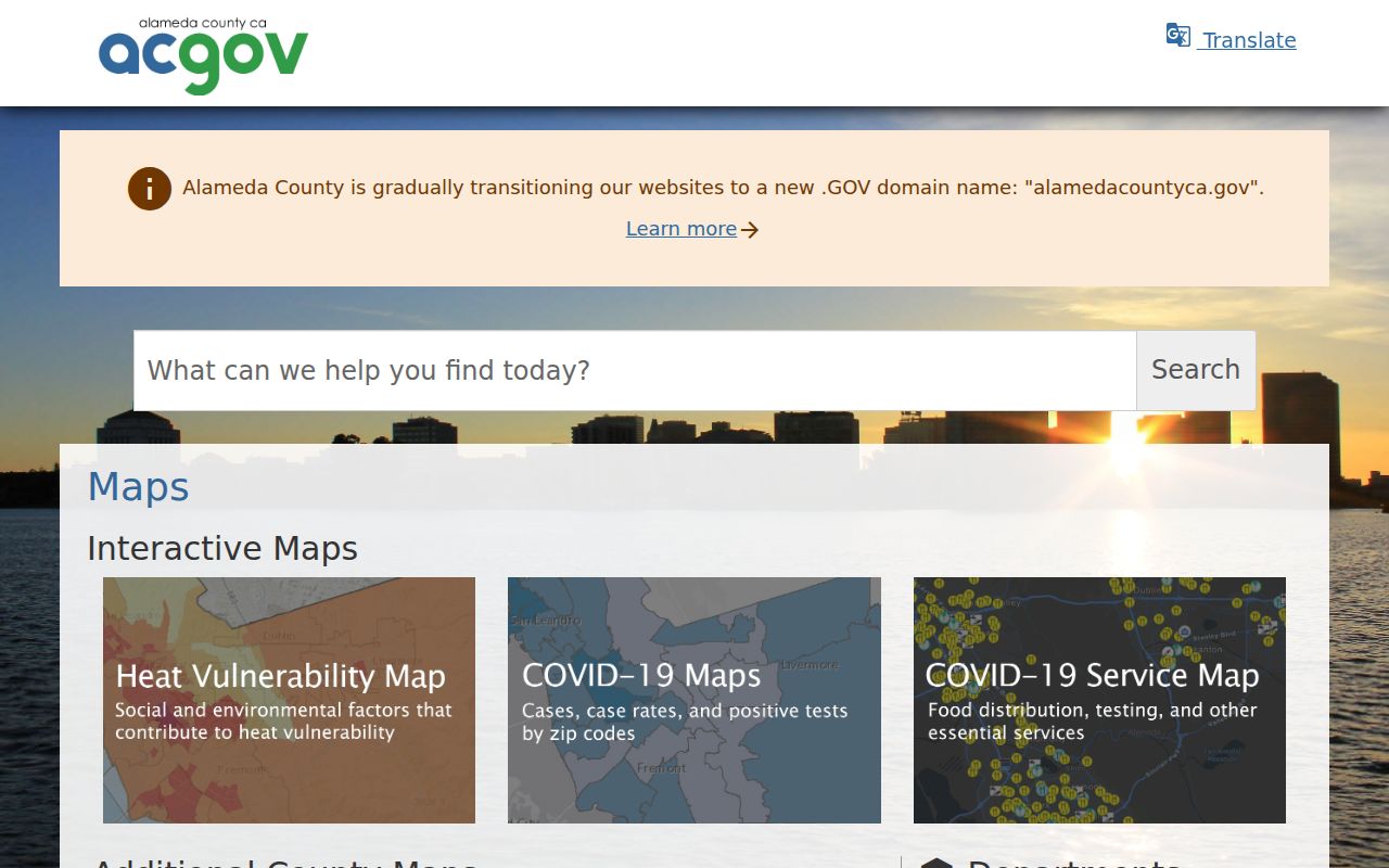
The map view supplies adjacency and jurisdiction context. It must be followed by an appropriate custodian search for any name claim.
Livermore Address Fields Explained
Three address fields answer different questions. Situs is the physical parcel. A tax-roll mailing address is where assessment correspondence goes and may be a business, trust, post-office box, or another home. A legal description identifies the land by lot, block, subdivision, or metes and bounds. Deeds rely on that durable legal identity more than on a street label.
USPS delivery data adds a fourth layer. A delivery address governs mail, but a postal city does not settle whether a parcel lies inside Livermore. Compare the City of Livermore boundary layer with the county parcel and address layers before choosing a municipal office. Keep each field in separate notes so a mailing match is not mistaken for household proof.
- Parcel
- A mapped unit of land identified by an APN.
- Situs address
- The physical location assigned to the parcel.
- Mailing address
- The destination used for tax or assessment correspondence.
- Legal description
- The deed identity that can survive a street-name or number change.
- Criss-cross directory
- A historical reverse section arranged by address, when a volume includes one.
Livermore Street Deed Records
Recorded documents are principally indexed by party name and legal description, not by a street address alone. The Alameda Official Public Records index is electronic from 1969 forward. Search a known owner as grantee near the acquisition date, inspect the deed for the grantor and legal description, then search that grantor as an earlier grantee. Before 1969, continue in manual grantor-grantee indexes, microfilm, and deed books.
The recorder’s online index is a finding aid. Preserve indexed party names and roles, document type, recording date, instrument number, book and page or reel and image, cross-reference, and APN when displayed. A copy order requires the instrument number and may add a convenience charge. The office does not perform title research or authenticate third-party conclusions.
Use the Alameda Official Public Records gateway to locate the index rules.
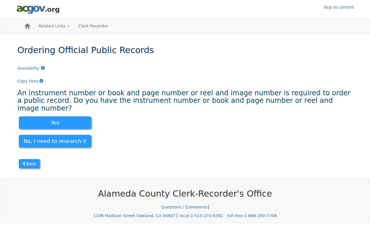
The gateway makes the 1969 cutoff visible. It also reminds a searcher that a title trail needs document review, not just a name hit.
Livermore Street Owners Need the Right Channel
When the property portal returns parcel facts without a name, the next lawful route is the Assessor public-records counter, limited telephone inquiry, or written request. The current owner then becomes a starting point for the deed chain. Do not label a permit contact, contractor, architect, engineer, service-request contact, or mailing recipient as the owner without corroboration.
The Recorder’s copy-order form asks for an exact instrument number. Plain copies are listed at $3.50 per page, certified copies at $4.50 for the first page and $3.50 for each additional page, with online orders adding a $2 convenience fee. Confirm the live schedule before ordering because posted fees can change.
Open the official-record copy order form to see the identifier route.
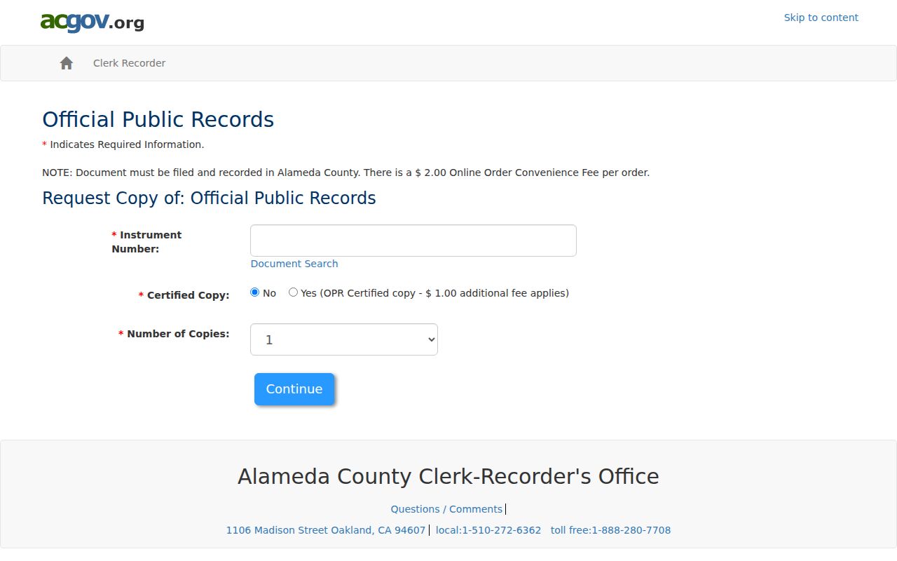
Once the document is in hand, compare the parties and legal description with the APN. That check is more reliable than treating an address-only search as a title result.
The recorder also offers a counter and mail research route for the 1853-1968 manual period. New records may take about two weeks before a copy can be ordered. For a recent recording confirmation by phone, have the document type and the parties ready. A plain copy is listed at $3.50 per page; a certified copy is $4.50 for the first page and $3.50 for each additional page, and an online order adds a $2 convenience fee. Confirm the current schedule before paying.
Livermore Permit Records Explain Address History
Livermore’s Accela Building search can be used without an account for public searches. It offers General Search, Search by Address, Search by Licensed Professional Information, Search by Record Information, and Search by Contact. Useful fields include record number, record type, date range, parcel number, project name, license type and number, contact names, street number, direction, street name, street type, unit type, and unit number.
Record types range from Building History and City Report to dwelling, demolition, photovoltaic, plumbing, pool or spa, roof, sign, solar, water-heater, and fire or revision variants. Use the category that fits the question. A contact may be an architect, engineer, contractor, owner-builder, or service-request contact, so a permit is evidence about a project, not a resident roster.
Start at the Livermore building permit search before reading the captured screen.
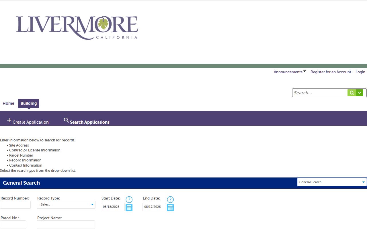
Match a permit parcel or normalized address to the county APN before connecting a name to the property. Legacy compiled material may be found under Building History or City Report.
Livermore Reverse Directories and Older Streets
Current parcel records are not enough for a historical street directory search. Livermore Public Library reference staff can check for “Polk,” “Haines criss-cross,” telephone directories, yearbooks, and family histories. The Heritage Guild History Center holds old business directories, maps, newspapers, property-tax logs, and volunteer indexes. Exact printed Livermore directory years were not verified in an official shelf list, so a missing online catalog entry should lead to a reference request, not an invented date.
For a past household, search a surname alphabetically, record the spouse, occupation, employer, home or rooming mark, street and number, telephone, widow notation, and any ownership symbol. Then turn to the reverse section if the volume has one. The full historical collection trail belongs with the Livermore city directories; the street directory here uses that shelf only to fill older occupant gaps.
Note: A vanished street number may reflect a move, omission, renumbering, subdivision, or a changed legal description.
What Livermore Street Records Leave Out
Public address records do not identify every household member, occupant, delivery recipient, utility customer, or DMV address. A homeowner exemption may support an owner-occupancy clue, but it does not enumerate a household. Voter records cannot be publicly browsed by street. California voter files are released only for election, scholarly, journalistic, political, or governmental purposes, and protected fields are withheld.
California’s privacy rules also create channel-specific limits. Safe at Home participants use a substitute address, while the Assessor’s owner information may be inspected offline even though it is absent online. A lawful personal search respects those boundaries and uses the custodian for corrections.
Lawful use. Livermore street and address records support personal research, family history, and civic questions. Do not use a name or address to stalk, harass, intimidate, or harm anyone.