
Livermore ZIP Code Directory Coverage
Two verified standard geographic ZIP codes serve Livermore. Their postal areas are broad, and neither one is an exact outline of the incorporated city. The ZIP code directory should therefore begin with USPS verification and end with parcel or city-limit confirmation.
| ZIP | Areas Covered | Post Office | Notes |
|---|---|---|---|
| 94550 | Central, south, and east Livermore plus broad rural and eastern territory | Livermore Post Office network | Standard ZIP; postal area extends beyond the incorporated boundary |
| 94551 | North and northwest Livermore, including territory north of the valley corridor | Livermore Post Office network | Standard ZIP; city and postal boundaries do not match |
The USPS city and state lookup is the controlling check for a mailing ZIP. A Census ZCTA is a statistical approximation and should not replace the delivery address.
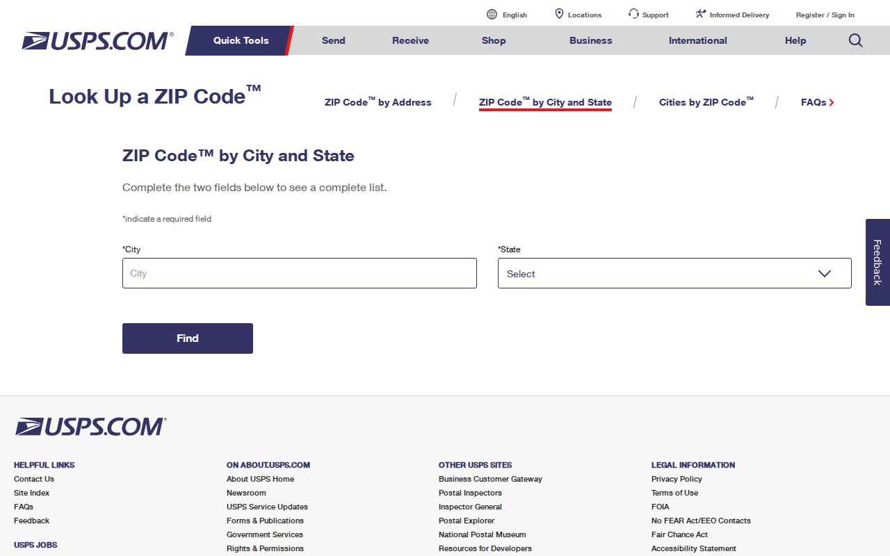
The USPS screen is useful when a directory, deed, or application uses a postal city that does not settle the municipal boundary.
94550 in the Livermore ZIP Code Directory
ZIP 94550 broadly covers central, south, and east Livermore, along with a large rural and eastern postal territory. A 94550 address can therefore belong to an incorporated parcel, an unincorporated county parcel, a business, or a rural delivery area. The ZIP code directory cannot decide which public office keeps a permit, council record, or city service file.
For a 94550 address, verify the full delivery line with USPS, then run the address through Alameda property assessment or tax search. Save the APN and situs, and compare the parcel with the City of Livermore boundary map. If the parcel is outside the city, county records may still apply even though the postal city reads Livermore.
Do not use the ZIP number as an APN shortcut. Parcel numbers are identifiers, not decoded neighborhood labels or resident clues.
94551 in the Livermore ZIP Code Directory
ZIP 94551 broadly covers north and northwest Livermore, including territory north of the valley corridor. The postal area is standard, not a verified unique or PO-box-only ZIP. The research did not confirm a street-by-street boundary from an official Postal Bulletin, so a precise dividing line should not be invented from a map impression.
The USPS notice records a major change: effective July 1, 2002, ZIP 94551 expanded to 14,364 deliveries that had previously been under 94550. That history explains why older address records can show a different ZIP while referring to the same place. Keep the edition date on a directory or letter when comparing eras.
The Livermore Post Office is listed at 220 South Livermore Avenue, Livermore, CA 94550-9998, with phone 925-447-0813. Posted retail hours are weekdays 9 a.m. to 5 p.m. and Saturday 10 a.m. to 2 p.m.; verify live before travel.
Open the USPS ZIP 94551 notice for the historical expansion record.
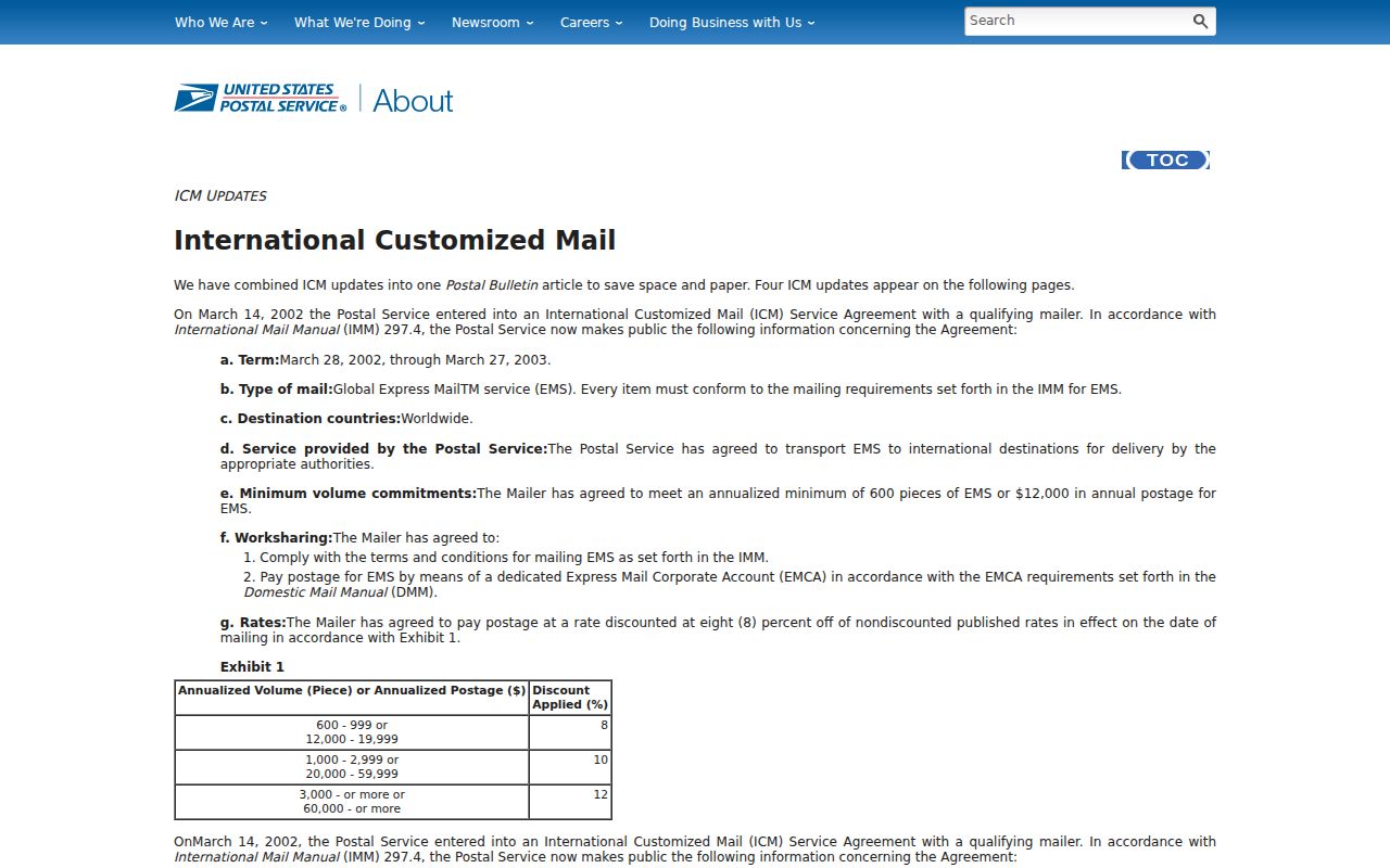
The notice supplies a dated postal change without pretending to publish the exact current street boundary.
Find Livermore Residents Within a ZIP Code
A ZIP code search must narrow an address set before it can support a record search. There is no verified public portal that returns every Livermore resident by ZIP. County property and tax tools accept a complete address through autocomplete, but the tax search does not advertise a ZIP-wide parcel browse. My Voter Profile is a self-check and has no public ZIP filter.
- Verify the postal city, ZIP code, and delivery line with USPS.
- Enter the complete address into county property assessment or tax search and choose the suggested value.
- Save the APN, situs, and tax or parcel details without treating the result as a person list.
- Use GIS to compare the parcel with Livermore city limits and adjacent geometry.
- Move to recorder, permit, historical directory, or approved voter channels based on the question.
Once a ZIP narrows the area to a street, the Livermore by-street workflow takes over. It is the address chain, not a ZIP-wide resident index.
Livermore Portals Accepting ZIP Addresses
Alameda’s property-tax search uses address autocomplete and parcel number as search routes. The County Parcel Viewer accepts address or parcel number and can zoom to a polygon. The City map includes address points, parcels, city limits, other city limits, and municipality layers. These tools make a ZIP-bearing address easier to place, but none publishes a complete ZIP-keyed resident directory.
| County property assessment | Address or APN; returns parcel facts and assessment detail, without online owner names. |
|---|---|
| County tax search | Full address autocomplete or APN; returns tax-bill and parcel information. |
| County Parcel Viewer | Address or parcel number; selects polygon and opens map attributes. |
| Livermore GIS | Address points, parcels, limits, land-use and district context through map layers. |
| My Voter Profile | Self-authenticated voter lookup; no public ZIP or block browse. |
Open the Alameda property-tax search to see the address and APN route. The Alameda County records and office page supplies the wider county access map.
The address form shows why a ZIP is a narrowing clue rather than a request for every parcel or person in an area.
Address fields also carry different meanings. The county tax portal’s autocomplete expects a complete property address, while an APN is entered with dashes and without leading zeroes. A situs is the physical parcel; a mailing address is the destination for assessment correspondence. A USPS delivery line can include a ZIP+4 that refines the route without changing the parcel or city-limit question.
Keep the original postal line in the note, then save the county’s normalized address and APN separately. That makes an older directory, a current tax record, and a GIS result comparable without forcing all three systems to use the same label.
Livermore Postal ZIPs Versus Census ZCTAs
A USPS ZIP code is built for delivery. A Census ZCTA is a statistical area made from residential and business addresses for demographic reporting. Their shapes can look similar while answering different questions. A ZCTA should not be used to decide whether an address receives Livermore city services or belongs to a county record jurisdiction.
For demographic context, Census QuickFacts reports the incorporated city rather than ZIP totals. The city’s 2020 Census population was 87,955, and the July 1, 2025 estimate was 83,457. Those figures describe the city geography, not every postal address using a Livermore ZIP code.
- ZIP code
- A USPS delivery geography used on a mailing address.
- ZIP+4
- An extended delivery code that refines a mailing route.
- ZCTA
- A Census statistical approximation of ZIP geography.
- PO-box-only ZIP
- A specialized postal area; none was verified for Livermore in the research.
- Carrier route
- A delivery route inside the postal system, not a city or resident boundary.
Livermore ZIPs and City Limits
Postal Livermore crosses the incorporated boundary into rural eastern Alameda County. County District 1 includes Livermore and much of the surrounding Livermore-Amador Valley. A 94550 or 94551 line therefore does not decide whether the City Clerk, Community Development, or a county department holds a record.
Use the City of Livermore Web Map to compare address points, parcels, Livermore city limits, other city limits, and municipality layers. Then use the county parcel or tax record to preserve the APN and situs. The delivery address, assessment mailing address, legal description, and civic boundary should stay as separate fields in a research note.
Note: A postal city answers where mail is delivered; a parcel and city-limit layer answer which local jurisdiction applies.
The 2002 Livermore ZIP Shift
The July 1, 2002 USPS expansion of ZIP 94551 moved 14,364 deliveries from 94550. That is a useful historical quirk for older directories, newspaper notices, deeds, and family papers. A pre-2002 address may carry 94550 even when a later postal lookup uses 94551. The change does not by itself redraw the city boundary or change the parcel’s legal identity.
When comparing records across the change, retain the source date, the printed ZIP, the street line, and the APN or legal description. The street and parcel fields usually provide a stronger bridge than a ZIP match. A current USPS verification should control present mail, while the historical source preserves what was printed at the time.
What Livermore ZIP Search Cannot Show
A ZIP code does not reveal every resident, a household roster, a voter list, a utility customer, or an exact city boundary. Property portals return parcel facts. GIS returns geometry and attributes. Voter access is restricted to self-service or approved purposes. Historical directories are collection-specific and may omit years. The strongest result is a complete address tied to a custodian record, not a ZIP-only name claim.
Use a ZIP code to choose the next question. For parcel ownership, move to assessment and recorder channels. For neighbors, inspect adjacent GIS parcels without claiming occupancy. For past residents, pair legal descriptions with directories, census, and newspapers. For civic jurisdiction, use the City map rather than the postal label.
The same caution applies to population figures. Census QuickFacts describes the incorporated city, not the postal territory. Its 2020-2024 measures include 30,922 households, 2.74 persons per household, 19.7% foreign-born residents, and 90.0% of people living in the same house one year earlier. Those statistics are city geography, not a count of addresses or residents in either ZIP code.
Lawful use. Livermore ZIP code and address records support personal research, genealogy, and civic understanding. Do not use a postal clue to stalk, harass, intimidate, or harm anyone.